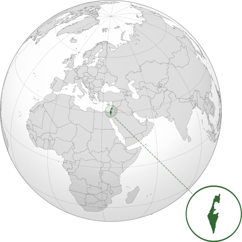
ಫೈಲ್:ISR orthographic.svg

Size of this PNG preview of this SVG file: ೬೦೦ × ೬೦೦ ಚಿತ್ರೊ ಬಿಂದುಲು. ಬೇತೆಪಟೊತ್ತ ಗಾತ್ರೊ: ೨೪೦ × ೨೪೦ ಚಿತ್ರೊ ಬಿಂದುಲು | ೪೮೦ × ೪೮೦ ಚಿತ್ರೊ ಬಿಂದುಲು | ೭೬೮ × ೭೬೮ ಚಿತ್ರೊ ಬಿಂದುಲು | ೧,೦೨೪ × ೧,೦೨೪ ಚಿತ್ರೊ ಬಿಂದುಲು | ೨,೦೪೮ × ೨,೦೪೮ ಚಿತ್ರೊ ಬಿಂದುಲು.
ಮೂಲೊ ಫೈಲ್ (ಎಸ್.ವಿ.ಜಿ ಫೈಲ್, ಸುಮಾರಾದ್ ೬೦೦ × ೬೦೦ ಚಿತ್ರೊಬಿಂದು, ಫೈಲ್ದ ಗಾತ್ರ: ೧.೩೯ MB)
ಸಾರಾಂಸೊ
| ವಿವರಣೆ | |
| ದಿನೊ | |
| ಮೂಲೊ |
ಸೊಂತೊ ರಚನೆ with Natural Earth Data This W3C-unspecified vector image was created with Inkscape . |
| ಲೇಕಕೆರ್ | Addicted04 |
ಪರವಾನಿಗೆ
I, the copyright holder of this work, hereby publish it under the following license:
ಈ ಫೈಲ್ ಕ್ರಿಯೇಟಿವ್ ಕಾಮನ್ಸ್ಡ್ Attribution-Share Alike 3.0 Unported ಲೈಸೆನ್ಸ್ದ ಅಡಿಟ್ ಬರ್ಪುಂಡು.
- ಇರೆಗ್ ಸೊಸಂತ್ರೊ ಉಂಡು:
- ಪಟ್ಯರಗ್ – ಬೇಲೆನ್ ನಕಲ್, ವಿತರಣೆ ಮಲ್ಪೆರೆ ಬೊಕ್ಕ ಸಾಗಾಯೆರೆ
- ಮಿಸ್ರೊ ಮಲ್ಪೆರೆ – ಈ ಬೇಲೆನ್ ಗಲಸೊನಿಯೆರೆ
- ಈ ತಿರ್ತ್ದ ಸರತ್ತುಲೆಡ್:
- ಕೃಪೆ – ಲೇಕಕೆರ್ ಅತ್ತಂಡ ಲೈಸನ್ಸರ್ ವ್ಯಕ್ತೊ ಮಲ್ತಿನ ರೀತಿಡ್ ಲೇಕನೊದ ಶ್ರೇಯೊನು (ಕ್ರೆಡಿಟ್) ಅರೆಗ್ ಕೊರೊಡು .(ಆಂಡ ಇರೆನ್ ಅತ್ತಂಡ ಈರ್ ಲೇಕನೊನು ಗಲಸಿನೇನ್ ಆರ್ ಸಮರ್ಥನೆ ಮಲ್ತಿಲೆಕೊ ತೊಜಪಾವುನ ರೀತಿಡ್ ಅತ್ತ್).
- ಇತ್ತಿನ ಲೆಕೊನೆ ಪಟ್ಟ್ಲೆ – ಈರ್ ಈ ಕೃತಿನ್ ಬದಲಾವಣೆ ಅತ್ತಂಡ ರೂಪಾಂತರ ಮಲ್ತ್ಂಡ, ಅತ್ತಂಡ ಈ ಕೃತಿತ ಮಿತ್ತ್ ಬೇತೆ ದಾಲ ಬೇಲೆ ಮಲ್ತ್ಂಡ, ಐತ ಫಲಿತಾಂಸೊ ಕೃತಿನ್ ಈ ಲೈಸೆನ್ಸ್ ಅತ್ತಂಡ ಇಂಚಿಂತನೆ ಲೈಸೆನ್ಸ್ದ ತಿರ್ತ್ ಮಾತ್ರ ವಿತರಣೆ ಮಲ್ಪೊಲಿ.
ಫೈಲ್ದ ಇತಿಹಾಸೊ
ದಿನೊ/ಪೊರ್ತುದ ಮಿತ್ತ್ ಒತ್ತ್ಂಡ ಫೈಲ್ ಆ ಪೊರ್ತುಡು ಎಂಚ ತೋಜೊಂದಿತ್ತ್ಂಡ್ ಪಂದ್ ತೂವೊಲಿ.
| ದಿನೊ/ಪೊರ್ತು | ಎಲ್ಯಚಿತ್ರೊ | ಆಯಾಮೊಲು | ಬಳಕೆದಾರೆರ್ | ಅಬಿಪ್ರಾಯೊ | |
|---|---|---|---|---|---|
| ಇತ್ತೆದ | ೦೯:೧೬, ೧೭ ಮಾರ್ಚಿ ೨೦೨೨ | | ೬೦೦ × ೬೦೦ (೧.೩೯ MB) | Chaddy | Reverted to version as of 06:27, 24 March 2019 (UTC), there is already another map for the disputed borders: File:Israel (orthographic projection) with disputed territories.svg |
| ೧೫:೧೮, ೧೦ ಮಾರ್ಚಿ ೨೦೨೨ |  | ೬೦೦ × ೬೦೦ (೧.೪ MB) | Beshogur | Reverted to version as of 06:25, 24 March 2019 (UTC) | |
| ೧೧:೫೭, ೨೪ ಮಾರ್ಚಿ ೨೦೧೯ |  | ೬೦೦ × ೬೦೦ (೧.೩೯ MB) | BlueHypercane761 | Reverted to version as of 22:09, 21 September 2016 (UTC) Self-revert. As legitimate as this revision is, I will split it off into a new image file. | |
| ೧೧:೫೫, ೨೪ ಮಾರ್ಚಿ ೨೦೧೯ |  | ೬೦೦ × ೬೦೦ (೧.೪ MB) | BlueHypercane761 | Restoring previous revision temporarily to retrieve image. | |
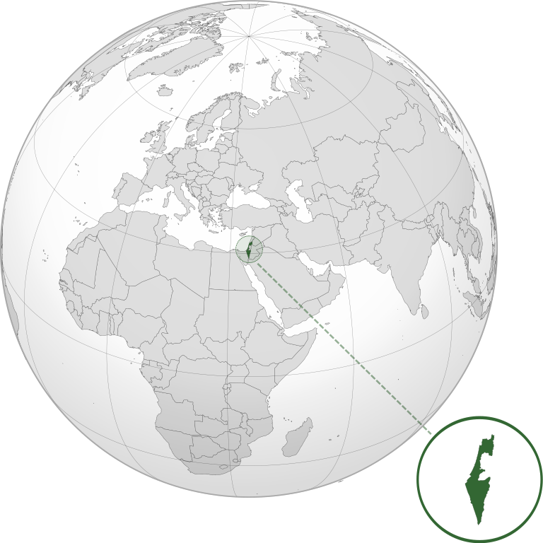
| ೦೩:೩೯, ೨೨ ಸಪ್ಟಂಬರ್ ೨೦೧೬ |  | ೬೦೦ × ೬೦೦ (೧.೩೯ MB) | Nableezy | make a new map, this one is fine | |
| ೦೦:೨೦, ೧೭ ಸಪ್ಟಂಬರ್ ೨೦೧೬ |  | ೬೦೦ × ೬೦೦ (೧.೪ MB) | Bolter21 | added disputed territories | |
| ೦೮:೩೬, ೮ ಜುಲಾಯಿ ೨೦೧೨ |  | ೬೦೦ × ೬೦೦ (೧.೩೯ MB) | Addicted04 | America land | |
| ೦೮:೧೨, ೮ ಜುಲಾಯಿ ೨೦೧೨ |  | ೬೦೦ × ೬೦೦ (೧.೩೯ MB) | Addicted04 |
_with_disputed_territories.svg)
ಫೈಲ್ದ ಉಪಯೋಗ
ಈ ತಿರ್ತ್ದ ಪುಟೊ ಈ ಫೈಲ್ಗ್ ಸಂಪರ್ಕೊ ಕೊರ್ಪುಂಡು.
ಜಾಗತಿಕೊ ಫೈಲ್ ಉಪಯೋಗೊ
ಈ ಫೈಲ್ನ್ ತಿರ್ತ್ ಉಪ್ಪುನ ಬೇತೆ ವಿಕಿಲು ಗಲಸುವ:
- af.wikipedia.org ಮಿತ್ತ್ ಉಪಯೋಗೊ
- am.wikipedia.org ಮಿತ್ತ್ ಉಪಯೋಗೊ
- arc.wikipedia.org ಮಿತ್ತ್ ಉಪಯೋಗೊ
- av.wikipedia.org ಮಿತ್ತ್ ಉಪಯೋಗೊ
- ay.wikipedia.org ಮಿತ್ತ್ ಉಪಯೋಗೊ
- azb.wikipedia.org ಮಿತ್ತ್ ಉಪಯೋಗೊ
- az.wiktionary.org ಮಿತ್ತ್ ಉಪಯೋಗೊ
- ban.wikipedia.org ಮಿತ್ತ್ ಉಪಯೋಗೊ
- bbc.wikipedia.org ಮಿತ್ತ್ ಉಪಯೋಗೊ
- bcl.wikipedia.org ಮಿತ್ತ್ ಉಪಯೋಗೊ
- bg.wikipedia.org ಮಿತ್ತ್ ಉಪಯೋಗೊ
- bh.wikipedia.org ಮಿತ್ತ್ ಉಪಯೋಗೊ
- bi.wikipedia.org ಮಿತ್ತ್ ಉಪಯೋಗೊ
- bn.wikipedia.org ಮಿತ್ತ್ ಉಪಯೋಗೊ
- bs.wikipedia.org ಮಿತ್ತ್ ಉಪಯೋಗೊ
- bxr.wikipedia.org ಮಿತ್ತ್ ಉಪಯೋಗೊ
- cdo.wikipedia.org ಮಿತ್ತ್ ಉಪಯೋಗೊ
- ceb.wikipedia.org ಮಿತ್ತ್ ಉಪಯೋಗೊ
- chr.wikipedia.org ಮಿತ್ತ್ ಉಪಯೋಗೊ
- ckb.wikipedia.org ಮಿತ್ತ್ ಉಪಯೋಗೊ
- cs.wikipedia.org ಮಿತ್ತ್ ಉಪಯೋಗೊ
- da.wikipedia.org ಮಿತ್ತ್ ಉಪಯೋಗೊ
- dty.wikipedia.org ಮಿತ್ತ್ ಉಪಯೋಗೊ
- el.wikipedia.org ಮಿತ್ತ್ ಉಪಯೋಗೊ
- en.wikipedia.org ಮಿತ್ತ್ ಉಪಯೋಗೊ
- en.wikibooks.org ಮಿತ್ತ್ ಉಪಯೋಗೊ
- es.wikipedia.org ಮಿತ್ತ್ ಉಪಯೋಗೊ
- eu.wikipedia.org ಮಿತ್ತ್ ಉಪಯೋಗೊ
- fi.wikipedia.org ಮಿತ್ತ್ ಉಪಯೋಗೊ
- fr.wikipedia.org ಮಿತ್ತ್ ಉಪಯೋಗೊ
- gn.wikipedia.org ಮಿತ್ತ್ ಉಪಯೋಗೊ
- gu.wikipedia.org ಮಿತ್ತ್ ಉಪಯೋಗೊ
- gv.wikipedia.org ಮಿತ್ತ್ ಉಪಯೋಗೊ
- hak.wikipedia.org ಮಿತ್ತ್ ಉಪಯೋಗೊ
- hr.wikipedia.org ಮಿತ್ತ್ ಉಪಯೋಗೊ
- hy.wikipedia.org ಮಿತ್ತ್ ಉಪಯೋಗೊ
- id.wikipedia.org ಮಿತ್ತ್ ಉಪಯೋಗೊ
- ie.wikipedia.org ಮಿತ್ತ್ ಉಪಯೋಗೊ
- incubator.wikimedia.org ಮಿತ್ತ್ ಉಪಯೋಗೊ
ಈ ಫೈಲ್ದ ನನಾತ್ ಜಾಗತಿಕ ಉಪಯೋಗೊನು ತೂಲೆ.